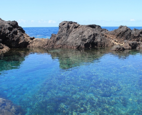
 https://tabaibaguesthouse.com/wp-content/uploads/2023/08/Natural_Pool_Garachico_Tenerife.jpg
600
900
Karin Flores Menéndez
https://tabaibaguesthouse.com/wp-content/uploads/2019/05/tabaibaguesthouse-logo.png
Karin Flores Menéndez2023-09-18 13:16:422024-03-09 17:14:54Natural Pools in Tenerife North
https://tabaibaguesthouse.com/wp-content/uploads/2023/08/Natural_Pool_Garachico_Tenerife.jpg
600
900
Karin Flores Menéndez
https://tabaibaguesthouse.com/wp-content/uploads/2019/05/tabaibaguesthouse-logo.png
Karin Flores Menéndez2023-09-18 13:16:422024-03-09 17:14:54Natural Pools in Tenerife North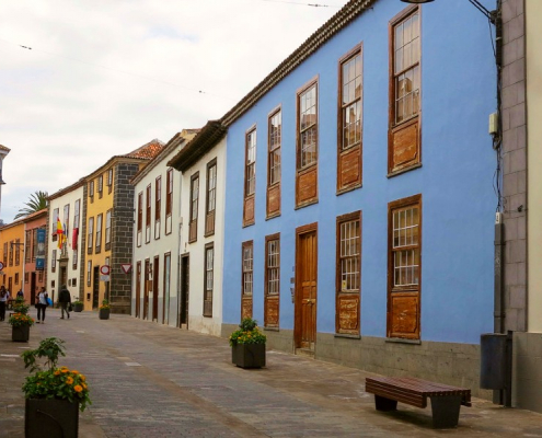 https://tabaibaguesthouse.com/wp-content/uploads/2022/10/La-Laguna-centre-tenerife.jpg
600
900
Karin Flores Menéndez
https://tabaibaguesthouse.com/wp-content/uploads/2019/05/tabaibaguesthouse-logo.png
Karin Flores Menéndez2022-10-30 15:58:012024-03-10 10:28:43Cultural Hike in Tenerife North
https://tabaibaguesthouse.com/wp-content/uploads/2022/10/La-Laguna-centre-tenerife.jpg
600
900
Karin Flores Menéndez
https://tabaibaguesthouse.com/wp-content/uploads/2019/05/tabaibaguesthouse-logo.png
Karin Flores Menéndez2022-10-30 15:58:012024-03-10 10:28:43Cultural Hike in Tenerife North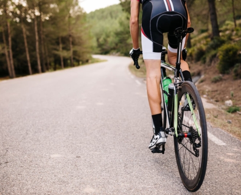 https://tabaibaguesthouse.com/wp-content/uploads/2022/02/cyclist-riding-a-racing-cycle-on-a-road-2022-12-16-22-12-29-utc-1.jpg
1080
1620
Karin Flores Menéndez
https://tabaibaguesthouse.com/wp-content/uploads/2019/05/tabaibaguesthouse-logo.png
Karin Flores Menéndez2022-02-27 14:50:112024-03-10 10:22:14Cycling in Buenavista del Norte
https://tabaibaguesthouse.com/wp-content/uploads/2022/02/cyclist-riding-a-racing-cycle-on-a-road-2022-12-16-22-12-29-utc-1.jpg
1080
1620
Karin Flores Menéndez
https://tabaibaguesthouse.com/wp-content/uploads/2019/05/tabaibaguesthouse-logo.png
Karin Flores Menéndez2022-02-27 14:50:112024-03-10 10:22:14Cycling in Buenavista del Norte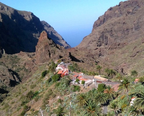 https://tabaibaguesthouse.com/wp-content/uploads/2019/10/Masca-Village.jpg
800
1600
Karin Flores Menéndez
https://tabaibaguesthouse.com/wp-content/uploads/2019/05/tabaibaguesthouse-logo.png
Karin Flores Menéndez2020-07-16 14:00:562024-10-11 17:47:37Masca Gorge: latest news
https://tabaibaguesthouse.com/wp-content/uploads/2019/10/Masca-Village.jpg
800
1600
Karin Flores Menéndez
https://tabaibaguesthouse.com/wp-content/uploads/2019/05/tabaibaguesthouse-logo.png
Karin Flores Menéndez2020-07-16 14:00:562024-10-11 17:47:37Masca Gorge: latest news https://tabaibaguesthouse.com/wp-content/uploads/2020/06/Coastal-Path-with-Mount-Teide-View.jpg
900
1600
Karin Flores Menéndez
https://tabaibaguesthouse.com/wp-content/uploads/2019/05/tabaibaguesthouse-logo.png
Karin Flores Menéndez2020-06-26 15:48:082024-03-10 10:30:14Trail in Buenavista del Norte
https://tabaibaguesthouse.com/wp-content/uploads/2020/06/Coastal-Path-with-Mount-Teide-View.jpg
900
1600
Karin Flores Menéndez
https://tabaibaguesthouse.com/wp-content/uploads/2019/05/tabaibaguesthouse-logo.png
Karin Flores Menéndez2020-06-26 15:48:082024-03-10 10:30:14Trail in Buenavista del Norte https://tabaibaguesthouse.com/wp-content/uploads/2020/05/Punta-de-Teno-Tenerife.jpg
900
1600
Karin Flores Menéndez
https://tabaibaguesthouse.com/wp-content/uploads/2019/05/tabaibaguesthouse-logo.png
Karin Flores Menéndez2020-05-19 19:15:382025-12-26 08:28:27Traveler’s Guide to Punta de Teno
https://tabaibaguesthouse.com/wp-content/uploads/2020/05/Punta-de-Teno-Tenerife.jpg
900
1600
Karin Flores Menéndez
https://tabaibaguesthouse.com/wp-content/uploads/2019/05/tabaibaguesthouse-logo.png
Karin Flores Menéndez2020-05-19 19:15:382025-12-26 08:28:27Traveler’s Guide to Punta de Teno