Trail in Buenavista del Norte
Fancy a walk by the sea with a salty breeze, mild climate and fantastic views? This trail in Buenavista del Norte in the northwest of Tenerife is a real insider tip. You will meet very few tourists as you explore the rural surroundings of Buenavista del Norte.
Start from the historic town centre and walk along the rugged coastline to an unspoilt beach with a panoramic restaurant. You follow an idyllic path through (almost) unspoilt nature along a green golf course, with beautiful views especially over the wide ocean and the Teno Mountains.
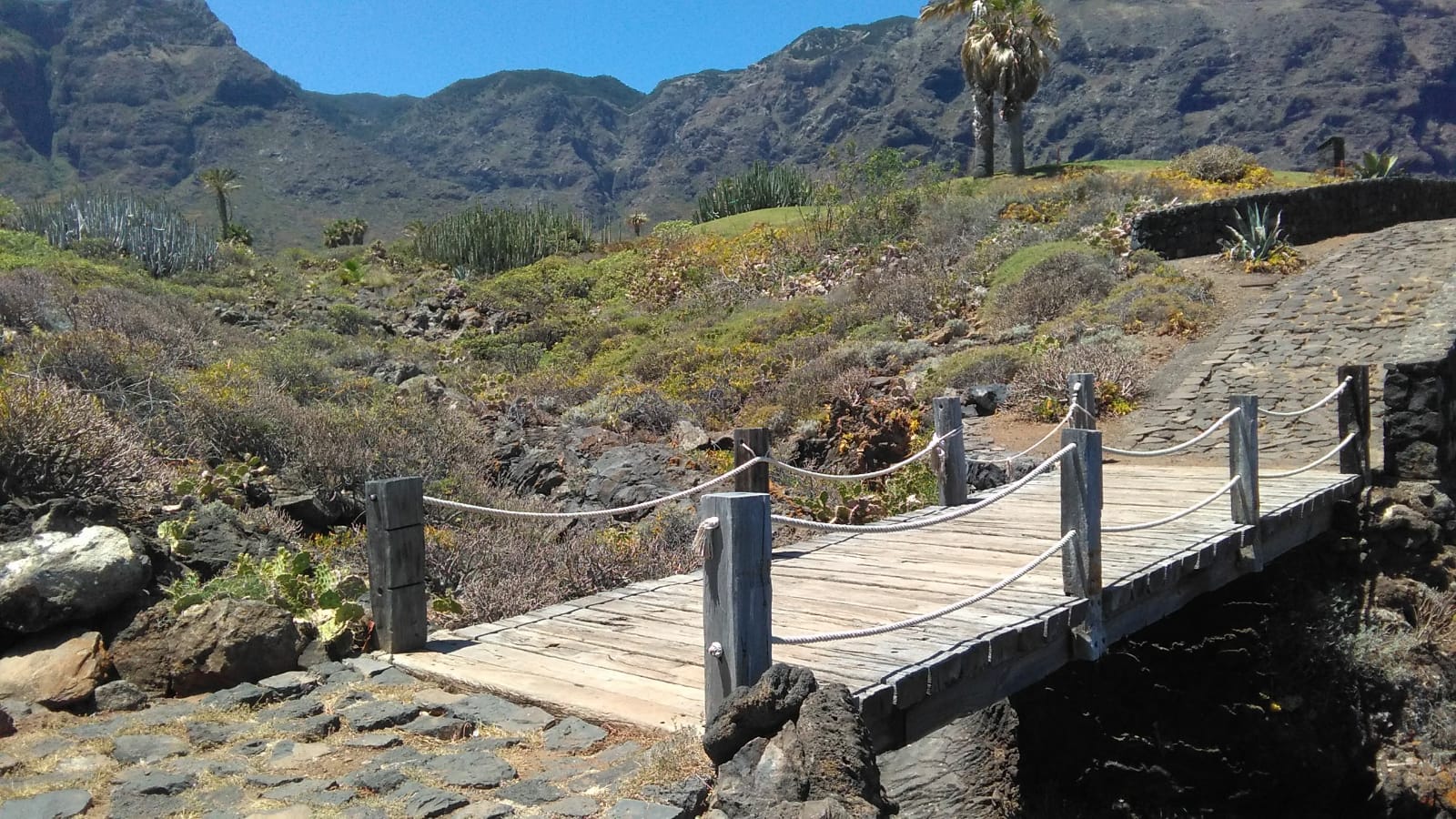
Wooden bridge on the coastal path through Buenavista del Norte with views of the Teno Mountains
Trail in Buenavista del Norte with 18 sights
This pleasant walk is 5.4km long and is more of a leisurely stroll. It takes about an hour and a half to complete, but if you want to take some great nature photographs and enjoy the stunning scenery, you will probably need two hours. The coastal path through Buenavista del Norte is an interesting short trip into the past and an ideal opportunity to gain an insight into the fascinating geology and natural history of Tenerife. We explain the 18 most important natural and cultural sites on this self-guided trail.
Starting point of the trail in Buenavista del Norte
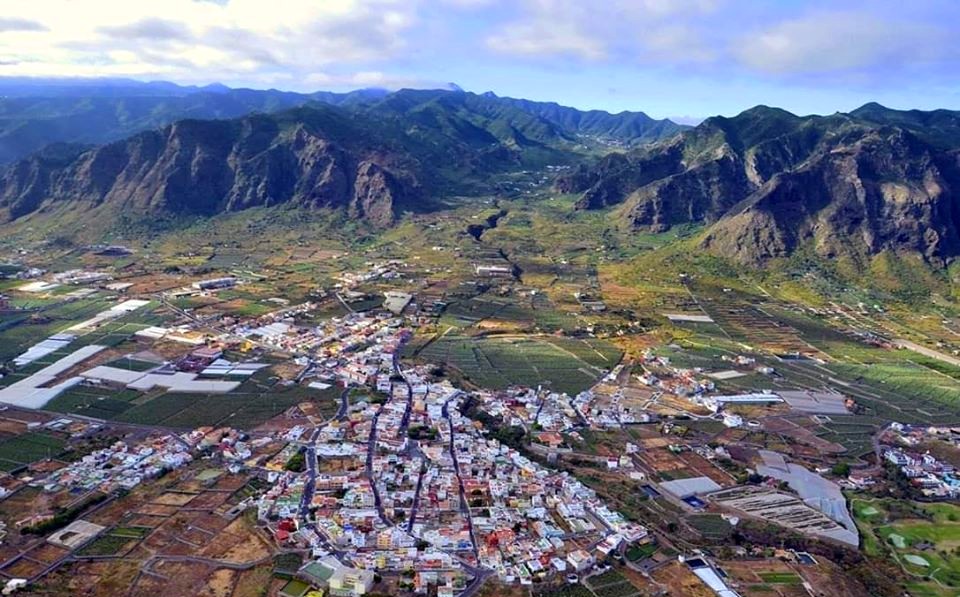
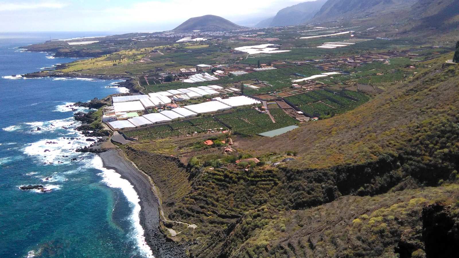
Aerial view of Buenavista del Norte at the foot of the Teno Natural Park
Buenavista del Norte is located in the most northwestern point of Tenerife, between a mountainous area with lush vegetation and the rugged Atlantic coast. It is a peaceful village, far from the crowded tourist areas, where it is easy to get in touch with the locals and their traditions. Thanks to its remoteness, a rich cultural heritage has been preserved in an unspoilt landscape.
The green and white path in Buenavista del Norte is signposted to Playa Las Arenas. It starts next to the Tourist Office in the town centre, in the Plaza de los Remedios (1), with its church and typical 16th-century Canarian houses. All the buildings around the square have old masonry and tiled roofs. There are two floors around a central courtyard, from which a wooden staircase leads to the rooms and spaces of the house. Typical features are the wooden sliding windows, some of which are asymmetrical. In 1983, the entire historic quarter of Buenavista del Norte was declared a Historic-Artistic Site.
Enjoy the Canarian way of life
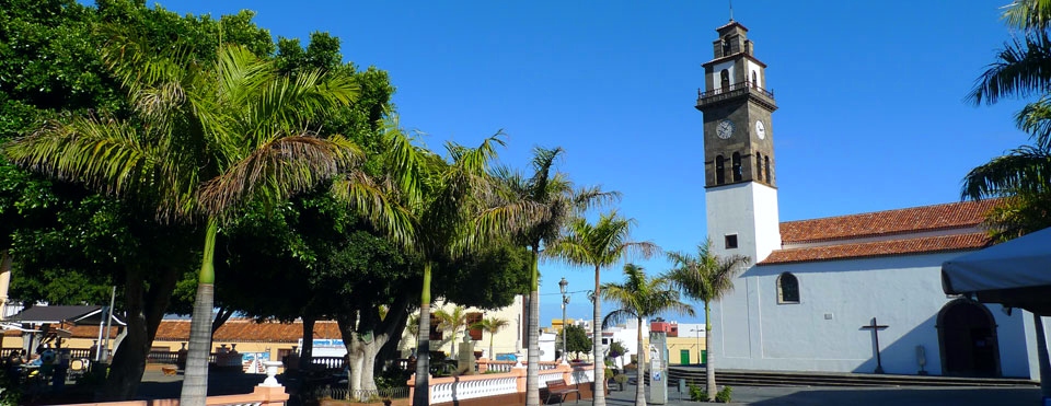
Plaza and church of Los Remedios in Buenavista del Norte
Before taking the coastal path through Buenavista del Norte, we suggest you stop for a coffee in the main square. Here you can relax under huge laurel trees and experience the local life of this beautiful Canarian village. The Canarians are a warm, outgoing and communicative people. In addition to the natural beauty of Buenavista del Norte, it is the contagious serenity of its inhabitants that makes the village a very special place.
Do you know where the name Buenavista comes from? It is said that the Spanish conquerors were so impressed by its location between the mountains and the sea that they spontaneously named it Buenavista, which means “beautiful sight”.
Typical scene on the coastal trail through Buenavista del Norte
Historical sites along the trail in Buenavista del Norte
Immediately after the square, you cross the Triana ravine, a green oasis with barbecue areas and the old Los Lavaderos wash-houses (2). The building is rectangular and has fourteen stone basins, each with an inlet and outlet. You will then pass banana plantations, some abandoned, some in active cultivation. At the chapel of La Visitación (3), the path branches off to the right down a small flight of steps, passing the historic 16th-century Hacienda de La Fuente (4), the manor house and former residence of the founder of Buenavista, Juan Méndez.
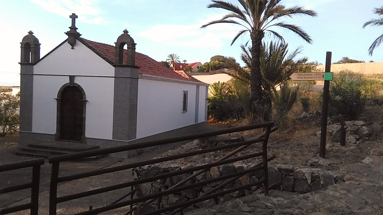
Chapel of La Visitación with the sign of the trail in Buenavista del Norte
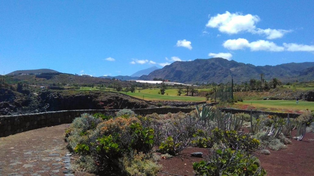
A narrow stony path takes you along the Buenavista del Norte golf course towards the Atlantic Ocean.

Buenavista del Norte golf course with the island of La Palma on the horizon
Important crop in the Canary Islands: the banana
This idyllic part of the trail in Buenavista del Norte is lined with colourful bougainvillea, opuntia, agaves and aloe. You can see the beautiful tropical banana trees from up close, without any disturbing fences (5). Did you know that around 140,000 tonnes of bananas are harvested in Tenerife every year? In short, more than 35,000 Canarios live from the cultivation of this delicious fruit and only about 10% is exported to other European countries.

Banana tree with still unripe fruits
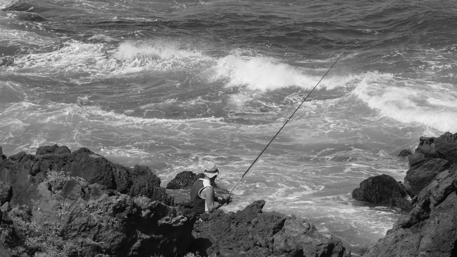
Playa de Los Barqueros viewpoint
The coastal path then passes through Buenavista del Norte and crosses the Triana ravine. At the mouth of the gorge, you reach the viewpoint of Los Barqueros beach (6), with a small chapel. It is worth taking a detour down to the picturesque cove that was once the village’s landing place. But be careful: there are signs warning of the danger of falling rocks. When the sea is calm, you can swim or snorkel here, but flip-flops are necessary because of the slippery rocks.
Former moorings of Buenavista del Norte: Playa de Los Barqueros
Basalt columns on the cliffs
On the opposite cliff of the bay you can see vertical basalt columns and even a stone daisy (7). These bizarre lava rock formations are striking and of great geological interest. Admire how nature has created spectacular landscapes out of rocks, like the work of a sculptor! The cooling process of the lava is crucial for the formation of these basalt columns, which are always formed when the lava flow cools very slowly.
Stone daisy on the cliffs of Playa de Los Barqueros
The green massif of the Teno Natural Park
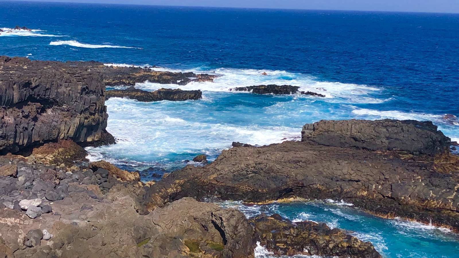
The coastal path through Buenavista del Norte is paved with individual lava stones and meanders along the rugged coastline. Few places in Tenerife feel so close to the Atlantic. The roar of the surf, the smell of iodine in the air and sea birds in the sky are balm for the soul. Walking shoes with a firm sole are certainly the best choice for this trail.

View of the rugged volcanic coastline from the trail in Buenavista del Norte
Similarly, the bright green of the golf course, designed by the famous Severiano Ballesteros, is a stunning contrast to the dark lava landscape. In the distance you can see the mountains and deep ravines of the Teno Mountains (8), the oldest part of Tenerife, formed by volcanic eruptions some eight million years ago. On days with good visibility you can take great photos of Spain’s highest mountain, the Teide volcano (3,718 m).
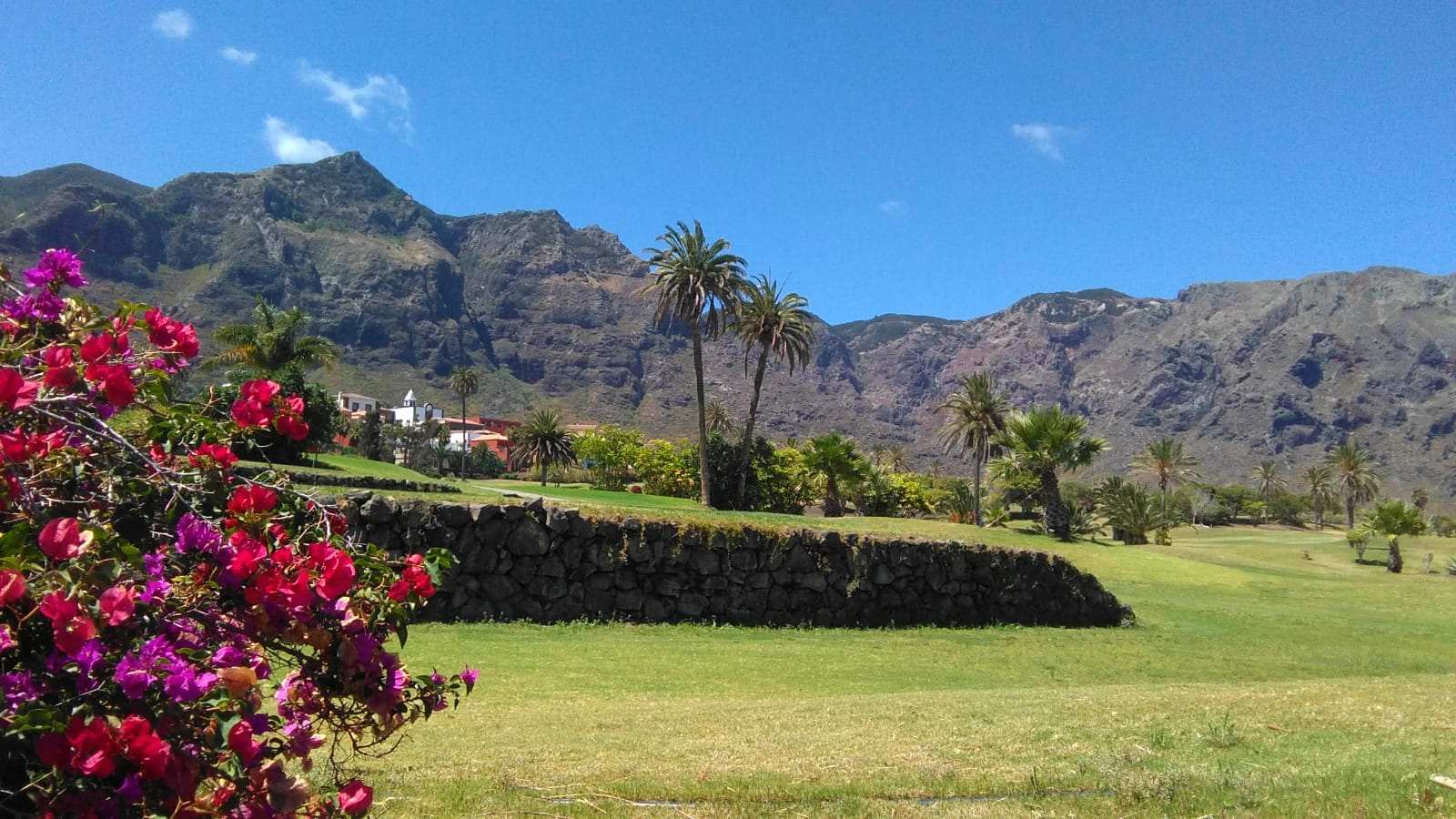
The Teno massif and Buenavista del Norte golf course
In addition, this stretch of coastline once played an important role in feeding the local population. Numerous concheros (pieces of shell) lying on the golf course are evidence of this. After collecting the mussels, the Guanches (Canarian natives) would separate the shell from the edible part in order to make the goods easier to transport.
Isla Baja – a volcanic platform
Isla Baja is the lower island at the foot of the Teno mountains (9). It was formed by recent volcanic eruptions close to the coast, where lava masses spread out like a fan. The Buenavista or Taco volcano has played an important role in shaping the relief of this part of the island. It underwent several eruptions, both underwater and from the air, which formed the lower island where the town of Buenavista del Norte is located today.
View of Isla Baja from the El Fraile viewpoint
Other eruptions took place at over 700 metres above sea level, and lava streams flowed through the gorges to form this vast platform over 300,000 years ago. As a result, the former Teno cliffs were pushed back from the coast. The newly formed Isla Baja consists of the villages of Buenavista del Norte, Los Silos, Garachico and El Tanque.
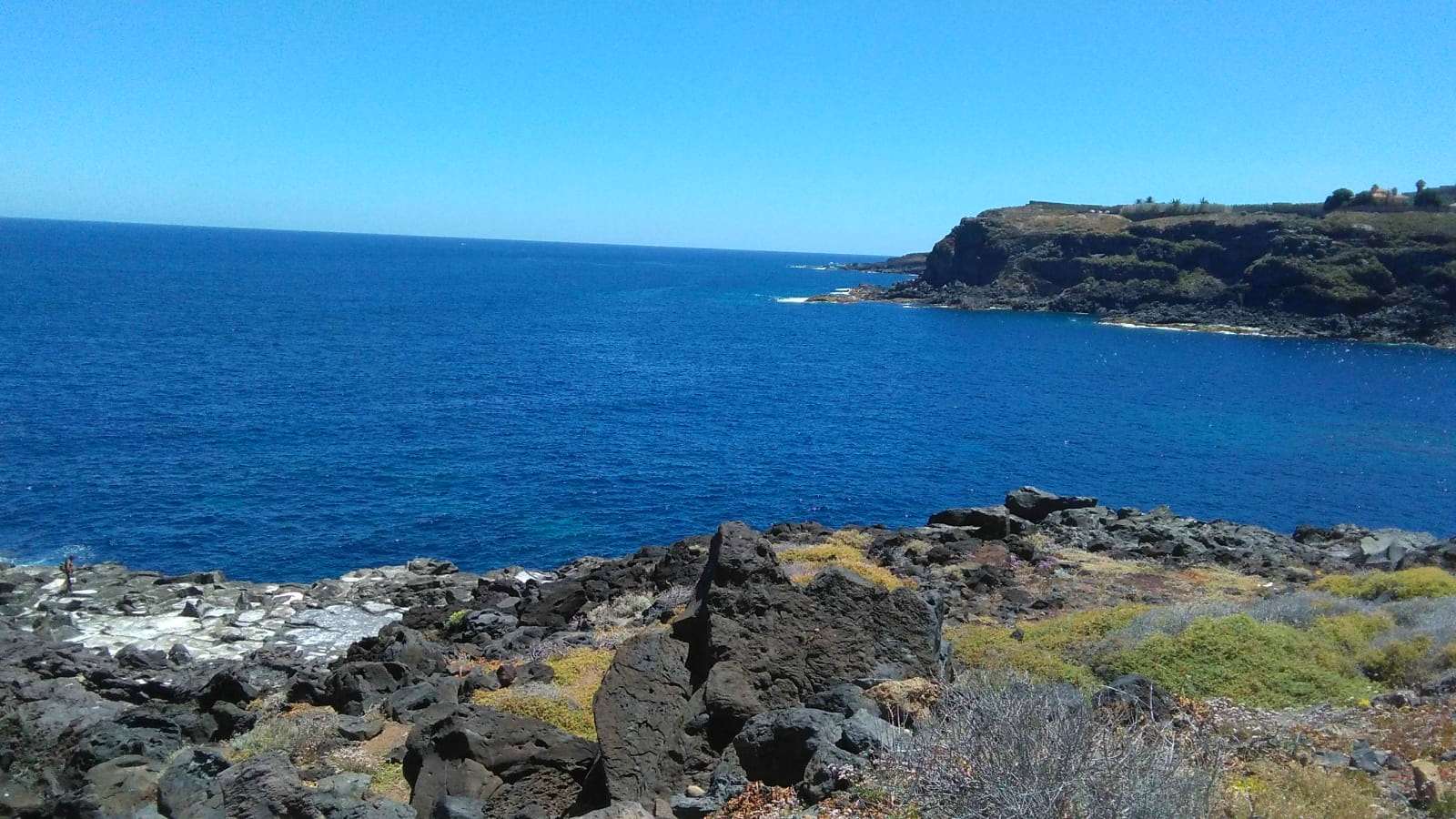
Magma that reached the sea and formed the new coastline
Salt pans on the coastal trail through Buenavista del Norte
In a long curve to the left, on the right you can see several shallow holes in the rocks (lajas) where salt was extracted in the summer: the salt flats of La Tablada (10). The Atlantic floods the salt flats with water, crystals form on the surface and the finished product can be collected. To speed up the evaporation process, the water was scooped by hand from the deeper holes. Salt was undoubtedly a valuable commodity for the inhabitants of Buenavista del Norte, not only for direct consumption but also for preserving fish. At one time there were 56 salt pans in the Canary Islands for the production of sea salt.
The white colour of the salt pans (left) stands out against the lava and the blue of the sea
Lava Ball
During your walk you will come across a very interesting geological phenomenon, the so-called accretion ball or volcanic egg (11), a large lava rock that formed just like a snowball. As it rolled over the liquid lava flow from the higher El Palmar valley, it grew in size until it finally reached the coast of Buenavista del Norte, where it solidified.
Lava ball from the valley of El Palmar
Plants on the coastal trail through Buenavista del Norte
As the largest and highest of the Canary Islands, Tenerife offers an impressive variety of flora. In just a few hundred metres, the vegetation changes radically, as different altitudes and microclimates create different vegetation zones or ecosystems. On your walk you will cross two of these.
The first is the coastal zone, at about 50 metres above sea level. Salt-loving plants grow here because they have adapted to the high salt content in the air (halophiles). Sea lettuce, sea parsley and sea fennel are typical plants. Secondly, there is the dry scrub zone, between 50 and 400 metres, with shrubby plants that can withstand the strong winds and sun. Typical shrubs of the spurge family are the tabaiba and the cactus-like Canary Island spurge or Cardón (12), both endemic. To learn more about the tabaiba plant, read our blog post How we came up with the name Tabaiba Guesthouse.
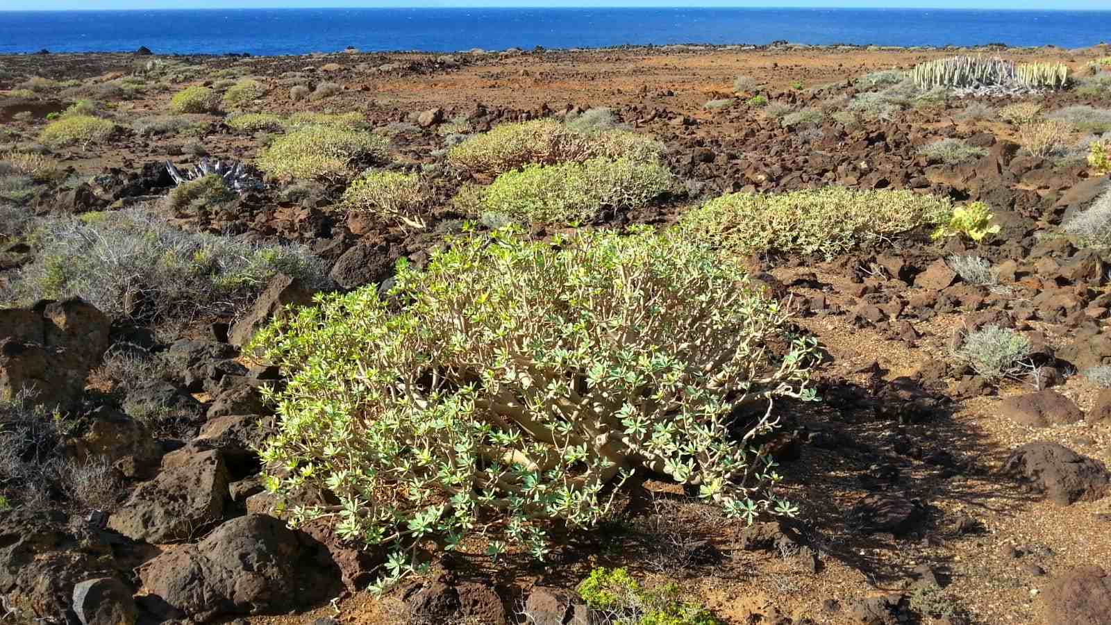
Typical plant along the entire coastal trail of Buenavista del Norte: the tabaiba

With its characteristic candelabra shape, the Cardón is one of the dominant plants in the coastal vegetation
Typical trees and shrubs of the Buenavista del Norte coast
Anyone who has travelled to the Caribbean knows it: the sea grape or uva de playa (Coccoloba uvifera), an evergreen shrub or small tree that can withstand salty sea air and near-desert conditions. Its ripe, dark red fruits are edible and are sometimes made into jam or juice. There are some beautiful specimens along the short beach promenade at the end of the trail in Buenavista del Norte.
Another typical plant is the Canary tarajal or taray (Tamarix canariensis), known botanically as the tamarisk. It is a dense shrub or small tree that grows on salty coastal soils or at the bottom of ravines. Its deep roots keep it firmly anchored to the ground even during storms. Its bark contains tannin (a tannic acid) and pigments that were used for medicinal purposes in the past. The tarajal is a very robust plant, able to adapt to changing and even difficult living conditions.
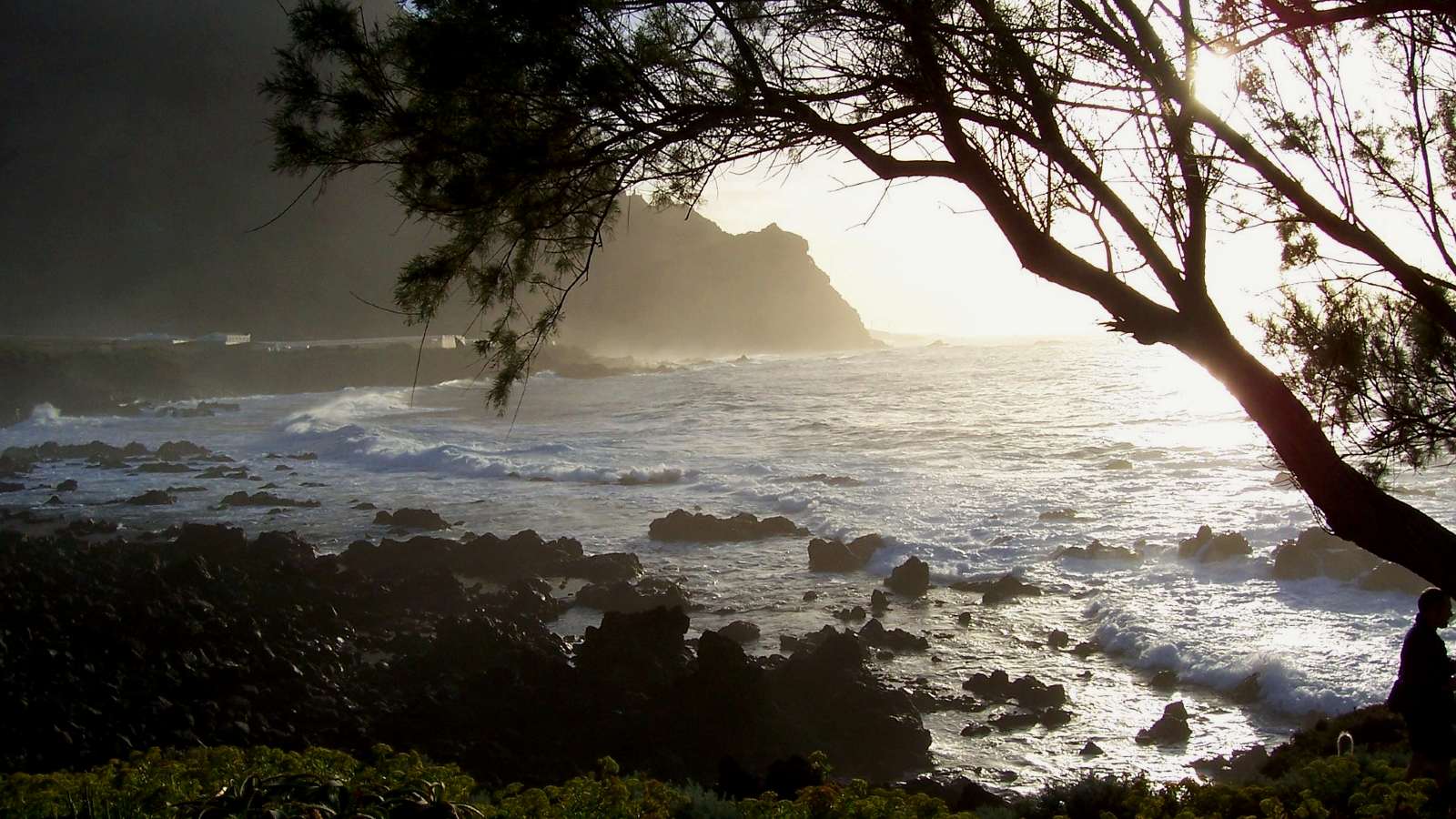
Sunset by the sea with a Tarajal (on the right)
What to do at the end of the route in Buenavista del Norte
Sport with sea views
The coastal trail through Buenavista del Norte ends at the heated public swimming pool (26 degrees Celsius) with gym and sauna (13). Athletic swimmers can enjoy the 25-metre seawater pool all year round. Admission is €4 per person. Open Monday to Friday from 10am to 10pm, Saturday from 10am to 2pm and closed on Sundays. Use of the sauna is by appointment and costs 3 euros per person (tel. 0034 922 12 81 01). To the right of the entrance, there are a number of outdoor exercise machines that visitors can use free of charge to work out in the sunshine and with views of the Atlantic Ocean.
Try the Canarian cuisine
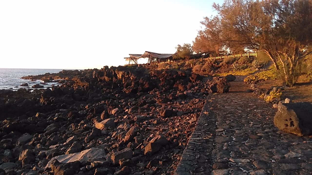
Beach restaurant overlooking the Atlantic Ocean
Opposite the pool is a lovely restaurant specialising in fresh local fish and seafood. It has a large terrace where you can enjoy a romantic sunset over the neighbouring island of La Palma while listening to the sound of the waves. A great place to dine or just enjoy a coffee or sundowner. Open daily from 12.00 to 21.00. If you prefer a picnic in the open air, the coast of Buenavista del Norte is the perfect place.
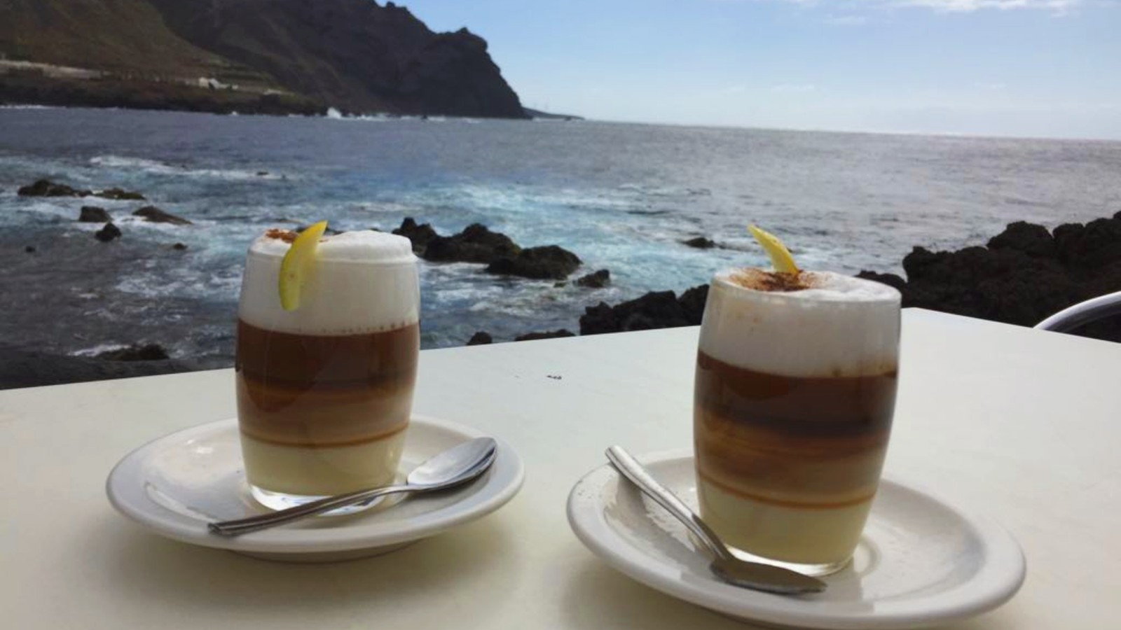
A barraquito (traditional coffee speciality) at the end of the trail in Buenavista del Norte
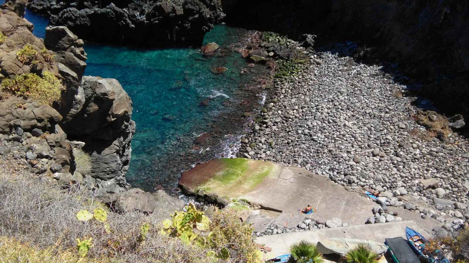
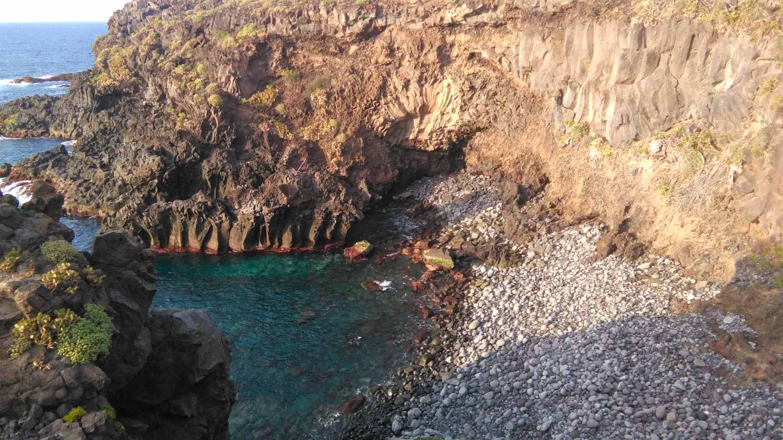
Lava pools for a unique swimming experience
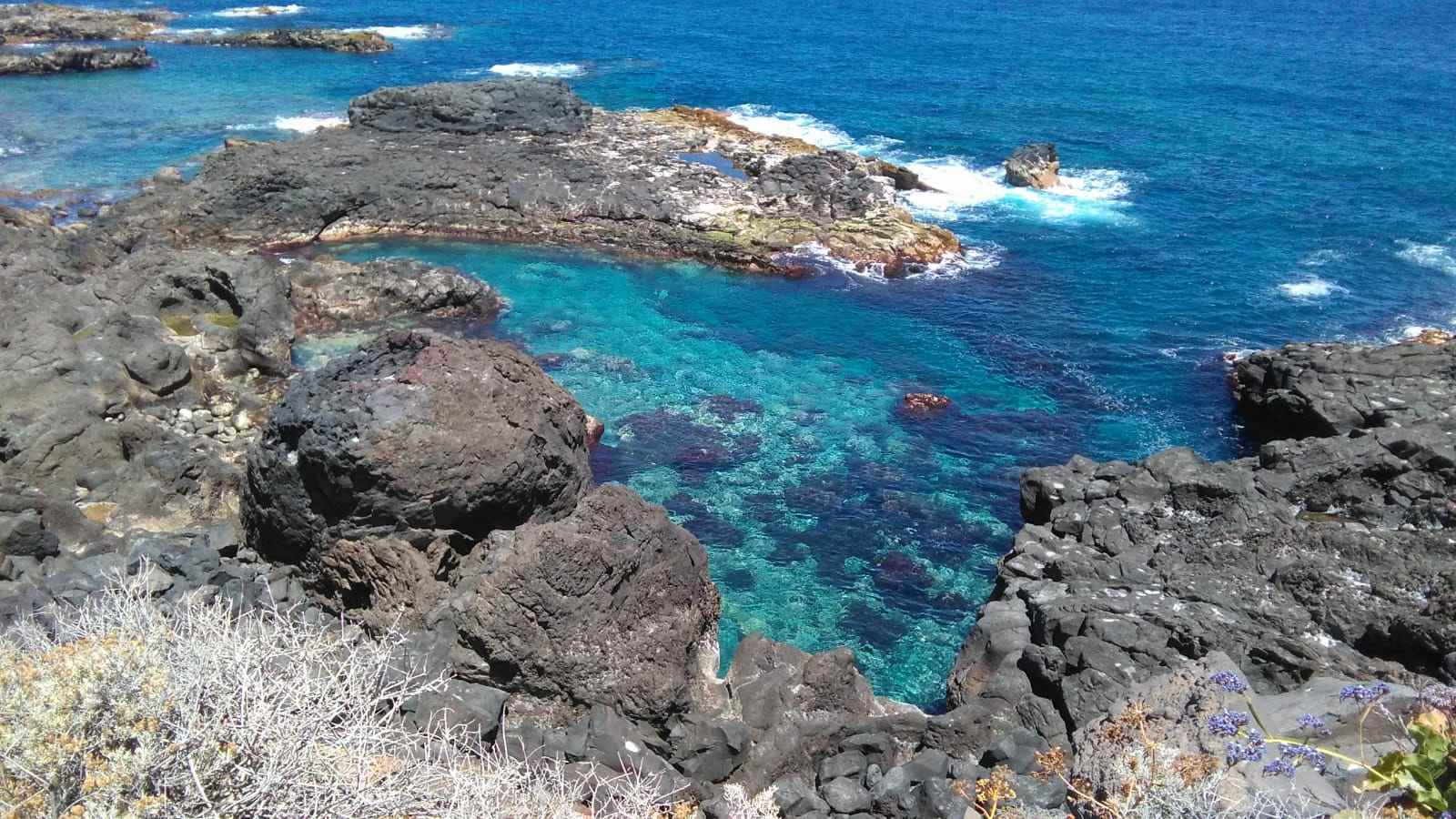
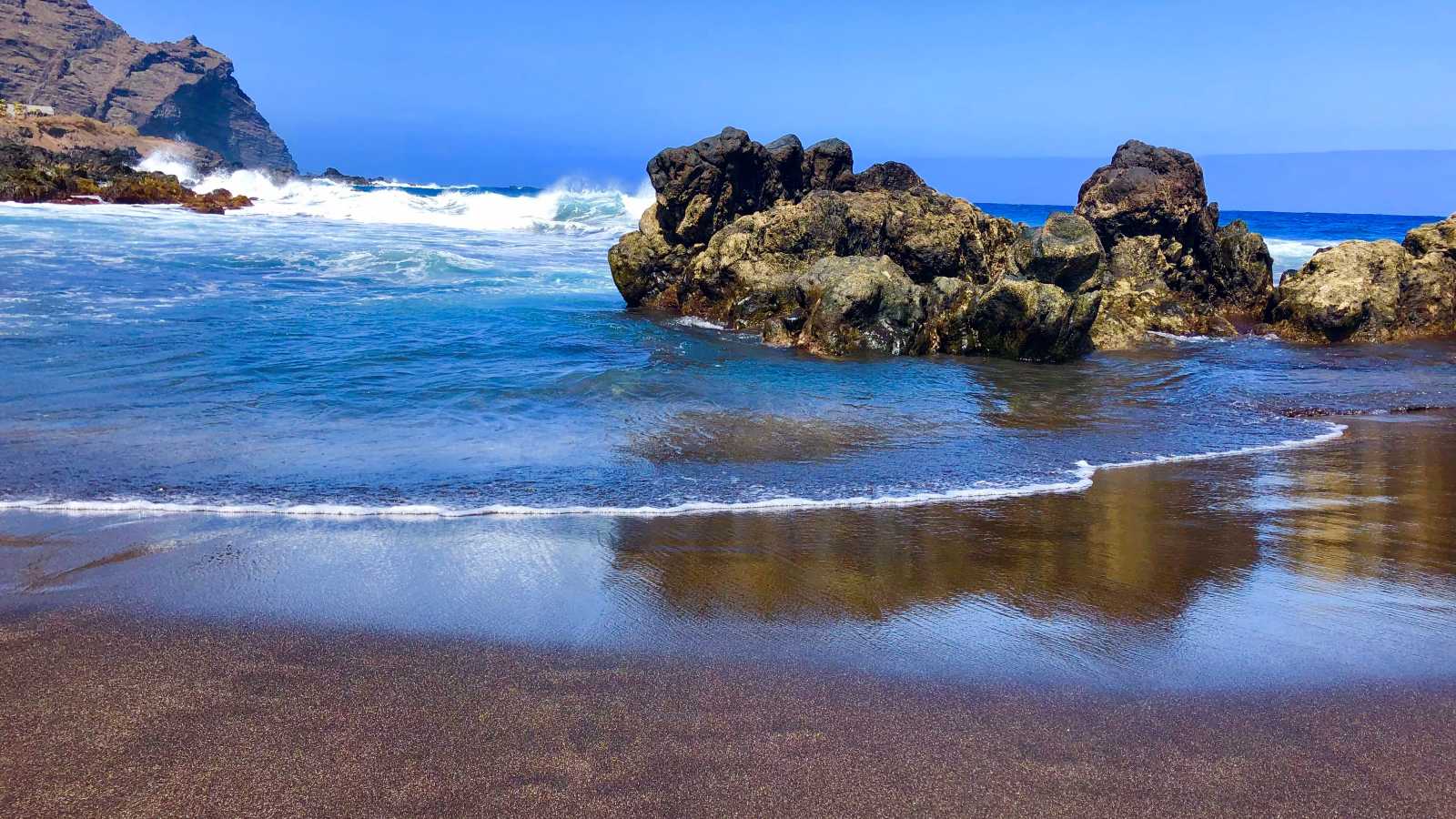
Bathing in the crystal clear waters of the Atlantic is always a pleasure, but the experience becomes unforgettable when you swim in one of the natural pools of the Canary Islands. These charcos are huge puddles of seawater that have formed naturally between the lava rocks. They are always filled with fresh water because of the tides. Next to the beach there are numerous charcos of different sizes where you can take a quiet swim, sheltered from the waves (14). Be careful when entering the pools, however, as the lava is very slippery and sometimes sharp-edged.
A day on the beach in black volcanic sand
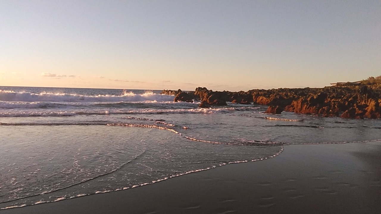
Sunset at Las Arenas beach with lava pools
The coastal path through Buenavista del Norte ends at Playa Las Arenas (15). Although it means ‘sandy beach’, the sand on this beach changes with the seasons: only from May to November do the tides bring the black volcanic sand to the shore. During these months it is mainly locals who spend their days off at this supervised beach, which is very popular with bodyboarders. Beware of strong currents and usually very high waves! In winter, the tides carry away the sand and the bay becomes a wild stone beach. All year round, this unique setting offers unforgettable sunsets.
Las Arenas beach in summer
Follow the trail to a secluded beach in Buenavista del Norte
If you want to continue exploring the coast, you can walk about 500 metres to El Fraile beach, an enchanting cove with big waves and spectacular views. Bathing is not recommended at this secluded beach. The path to El Fraile beach starts at the end of Las Arenas beach, on a picturesque wooden bridge (16) behind the beach kiosk.
Return to Buenavista del Norte
You can return either by the same coastal path or by a little-used tarmac road. This starts about 20 metres in front of the beach restaurant at the roundabout (17) with a car park for campers, and continues uphill along the golf course to the Melià Hacienda del Conde Hotel (18). The architecture of this 5-star hotel is reminiscent of a magnificent palace. The hotel’s spa offers a thermal circuit, sauna and Turkish bath. Massages can also be booked by non-guests.
Walking back to Buenavista del Norte, Hotel Melià Hacienda del Conde seen on the left
At the end of the road, turn left and follow the cobbled path down to the Hacienda del Conde (4). After a few metres uphill, you will pass the chapel of La Visitación (3), and shortly afterwards, you will rejoin the signposted path to Buenavista del Norte.
Download the trail in Buenavista del Norte
We invite you to discover this pleasant walk during your next visit to Buenavista del Norte and hope that our description will help you. If you are looking for peace and quiet, this is the ideal route for you!
Don’t be afraid of getting lost and download the full map of the route with the main points of interest.
Tabaiba Guesthouse offers you the perfect accommodation to explore the green northwest of Tenerife. Book your stay with us for an authentic holiday experience. We also know other wonderful trails in the surrounding area, which we will introduce to you in this blog. If you would like to discover them with our in-house professional mountain guide, contact Sergio Walking Tours
See you soon!
Karin and Sergio